
We have created a surveying and planning solution which eliminates the need for expensive scaffolding and cherry pickers, or the risks of staff working at height, while dramatically speeding up the process of assessing large numbers of buildings.
First watch this video for an explanation of what we can achieve with simple photography from your local drone operators.
3D Building Modelling from Drones
We can generate photorealistic three-dimensional models capable of being viewed in virtual reality using nothing more than high-resolution photos captured by unmanned aerial vehicles or drones.
As no specialist scanning hardware is required, any drone operator with a high-definition camera can provide the input we need
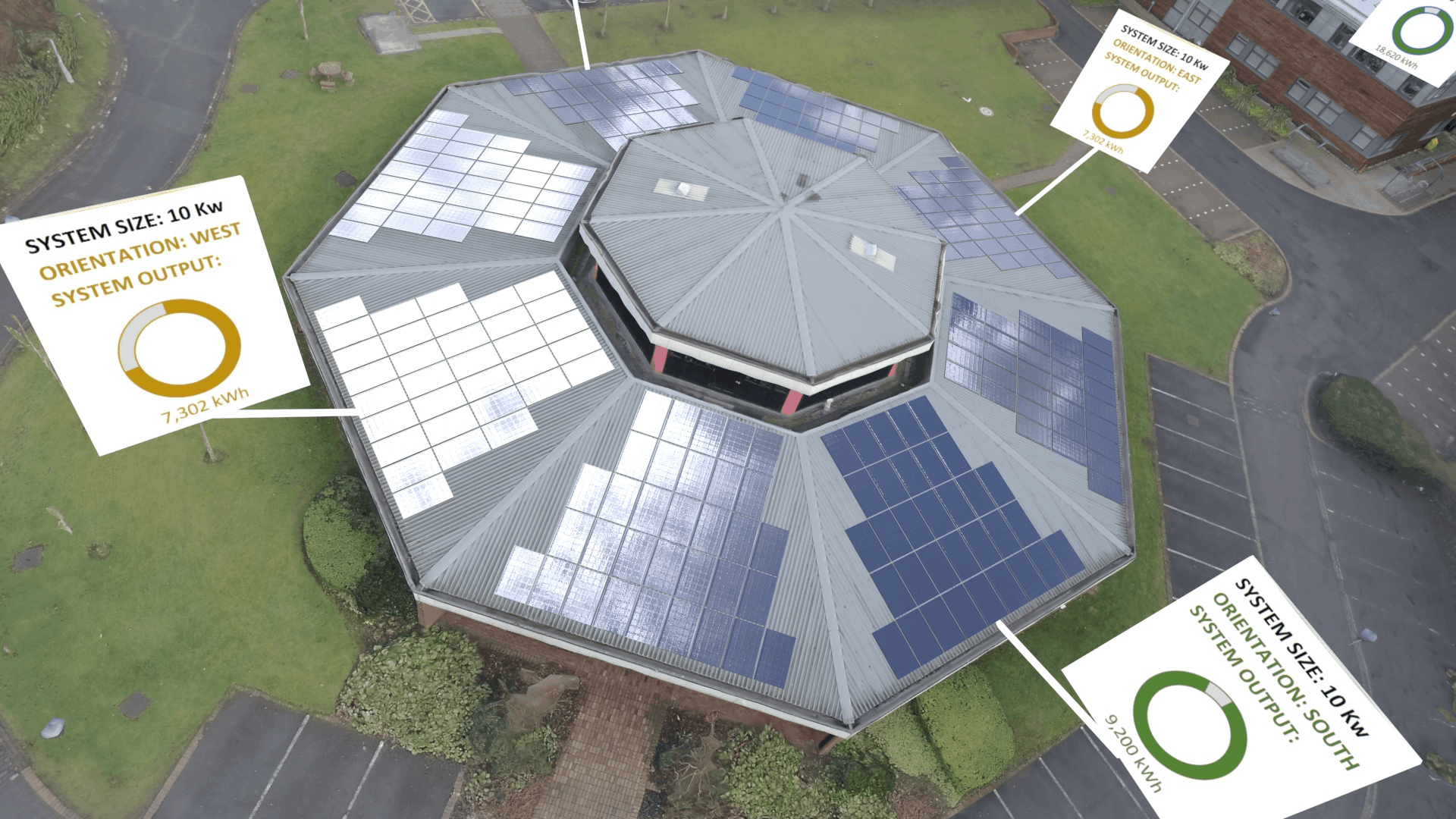
Solar Panel Installation Planning
Once these models are complete, your engineers can remotely assess any number of building’s suitability for solar panel installation, accurately assessing the power generation capabilities of each roof surface according to direction, angle and shading from nearby trees and buildings.
Improved Accuracy
In fact, as well as being far cheaper and faster than sending a specialist engineers to carry out the work in person, by eliminating human error, this approach can actually be more accurate than traditional on-site measurement methods.
Reduced Time and Costs
Most importantly, as dozens of buildings can be scanned in a single day, for the first time busy domestic areas can realistically be assessed within tight time and financial budgets.
BIM Planning - Construction and Demolition
As these models can be fully manipulated, we can remove trees and buildings planned for demolition and even add and assess buildings planned for construction using nothing more than BIM architectural planning models.
Damage and Heat Loss Assessment
On top of this, these models can be used to assess damage or wear and tear to roofing create accurate grade-level visualizations for local residents and other stakeholders and, with the additional of infra-red, can even be used for heat loss assessments to help improve buildings energy efficiency.
With the time and cost savings, features and benefits of this aerial modelling approach, there are many reasons to adopt this technology in sustainable property development.
Contact us by email or call us at 0141 370 3096 to learn more.